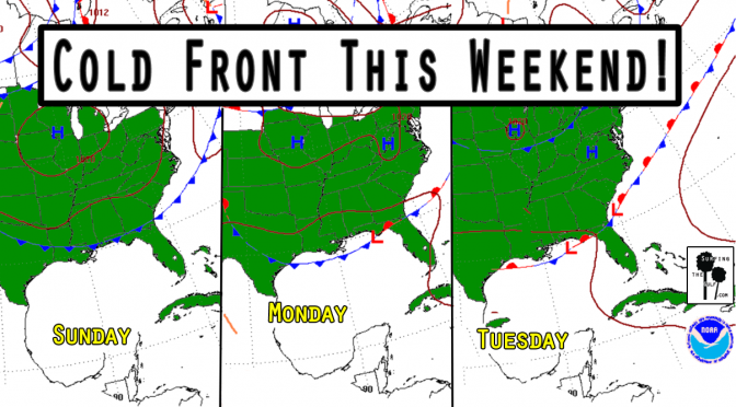
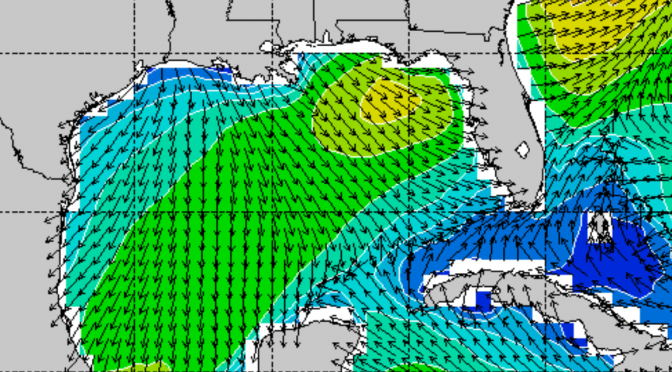
Is it too early to start talking about Fall? It’s not quite Fall, but this cold front doesn’t know that. We’re currently in a pattern of high pressure and light onshore winds with low rain chances. A frontal boundary approaches our area on Sunday. As the front approaches, the pressure gradient will tighten. The tightening pressure gradient will increase the southwest winds. This will increase the humidity and the rain chances. Surf’s up by Sunday afternoon, peaking overnight. Monday the surf continues. The fetch will extend from all the way over by Texas, so the swells should be well formed. The forecast is for 2-4 foot seas at its peak. It’ll be a nice waist high or better swell. The change in the pattern should bring down the temps four or five degrees. Nothing epic, but it could get shortboardable.
Tag Archives: seas
Gulf Coast Surf Forecast: Week of April 03, 2017
If you didn’t already know, the surf is on its way up right now. There appears to be a small wave on the beach at the south swell spots. There are gusty south winds in front of the cold front. The front is expected Continue reading Gulf Coast Surf Forecast: Week of April 03, 2017
Cold Front: The Surf Forecast 02.25.17 (updated Wed, Mar 1st)
WFL Wednesday March, 1st 2017 update: Friday the surf comes up to around 4-5 feet at 6 seconds from the northwest, with winds from the north. The surf peaks between noon and 3pm. The skies will be cloudy in the morning, clearing by afternoon. The highs are in the low 70s. In Clearwater the tide comes in from 8:30a-2:30pm, about 2 feet. Then, the tide drops about 2.5 feet until just after 9pm. Continue reading Cold Front: The Surf Forecast 02.25.17 (updated Wed, Mar 1st)


