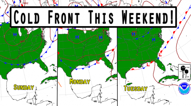
Is it too early to start talking about Fall? It’s not quite Fall, but this cold front doesn’t know that. We’re currently in a pattern of high pressure and light onshore winds with low rain chances. A frontal boundary approaches our area on Sunday. As the front approaches, the pressure gradient will tighten. The tightening pressure gradient will increase the southwest winds. This will increase the humidity and the rain chances. Surf’s up by Sunday afternoon, peaking overnight. Monday the surf continues. The fetch will extend from all the way over by Texas, so the swells should be well formed. The forecast is for 2-4 foot seas at its peak. It’ll be a nice waist high or better swell. The change in the pattern should bring down the temps four or five degrees. Nothing epic, but it could get shortboardable.
