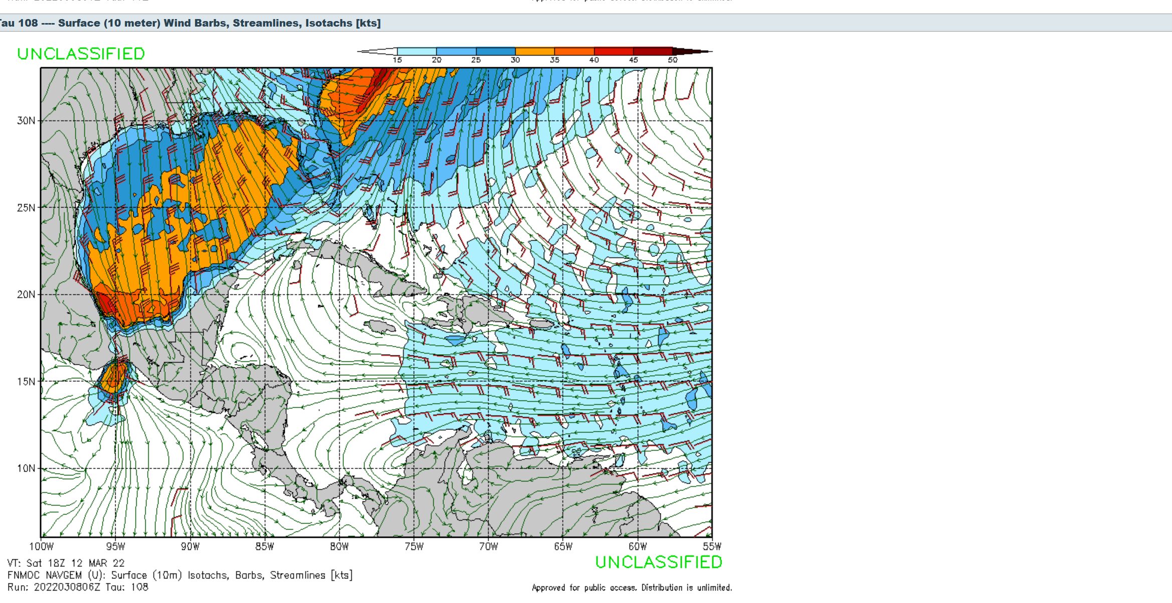
After a very, very long lull in real surf something significant is showing up on the map. The latest model run is showing an especially strong cold front dropping into the gulf on Saturday. The winds look to go offshore on Sunday, actually happening sometime overnight between Saturday and Sunday. 30p knot winds on the model mean this front should be just about one of the strongest cold fronts we get. If cold fronts were categorized like hurricanes on a saffir-Simpson scale this would be right around a 4 as it looks right now. Hopefully this pans out and we get a nice cool-down while at the same time getting slabs rolling into your local beach. It’s finally time to get back in the water.

