If you didn’t already know, the surf is on its way up right now. There appears to be a small wave on the beach at the south swell spots. There are gusty south winds in front of the cold front. The front is expected to become a stationary front as it gets to the middle of the Gulf of Mexico. After that happens the winds behind the front which are strong from the northwest shift to a light southeast wind. You can expect to see surf from this front this evening and tomorrow, primarily southwest swell from the prefrontal winds. This evening looks like it will be the best time to surf. Tomorrow should still have a wave. Cruise over to the weather instruments page to check out what’s happening at the beach at this very moment, and into the near or distant future.
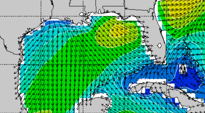
Then, the more interesting thing is the front coming at the end of the week. This Thursday, by mid-day solid swell will be filling in at the beach. A strong cold front is bringing one of the last solid swells of the season, and by solid I mean really fun on a shortboard. The start of the front will be weak southwest swell in the morning. Mid-day thursday west swell fills in for a brief window. Then, in the evening the biggest swell will have arrived and be from the northwest. The featured image is for Thursday at 6pm. The surf will remain on Friday. Mid-day Thursday through the entire day Friday, the surf will hold in place with strong northwest winds.
The high on Thrusday is 76°, and 72° on Friday. The water at Pier 60 is a warm 75°, and probably won’t change much for the upcoming front. We’ve got spring high tides in the evening, which means extra high water levels, and rides all the way through to the beach.
